


 268 / 444

218
Description of the region Bobo Dioulasso in Burkina Faso (formerly Haut-Sénégal-Niger and
Upper Volta), 1890-1915. Probably compiled by a French officer and unpublished. At the beginning
a list of “Les commandants du Cercle” (1897-1911). Loosely inserted: 4 typed ff. from a similar
paper, and a German summary (2 ff.).
1027
[Africa]
-
KLEMP, Egon
- Africa on maps dating from the twelfth to the eighteenth century =
Africa auf Karten des 12 bis 18 Jahrhunderts. Leipzig, Leipzig Edition, (1968), folio, 53 cm, orig.
cloth on boards, flat spine (a few clear foxing spots on covers, spine and top edge), printed title
on cover, 77 mostly double-pp. (fingerprint on verso of a map, clear discol. on 1st endpage), with
inserted textbooklet, 4to, 61 pp. Kept in a cloth covered slipcase (some minor clear soiling). Fine
copy.
€ 100/150
1st edition
by editor and author Egon Klemp, on behalf of the Deutsche Staatsbibliothek Berlin.
Fac-simile prints of ancient maps, English version. With
77 maps partly in color
, mounted on stubs.
Complete with explanatory booklet.
1028
[Algeria]
-
LAUGIER DE TASSY, Jacques-Philippe
- Beschryving van het koningryk ende stadt
Algiers, met den tegenwoordigen staat dier regeeringe, landt- en zeemacht (...) recht en koophandel
(...) met een Lijst der genomene Hollandtsche schepen [trsl. from the French]. Amsterdam, M.
Schagen, 1725, 4to, cont. blindstamped vellum, spine on 6 raised bands, [16]-300-[16] pp. (some
minor spotting or soiling). Good large paper copy.
€ 400/600
Rare Dutch ed. of “Histoire du royaume d’Alger” (The Hague 1725) with an up-to-date survey of
Algiers and its government, economy etc.
Engr. ills
: front., folding map and 2 pls (i.a. a
large view
of Algiers
, tear rep.). Engr. mark on title. Title in red and black.
Ref.
Tiele 644. STCN (i.a. BL). Not
in BnF.
1029
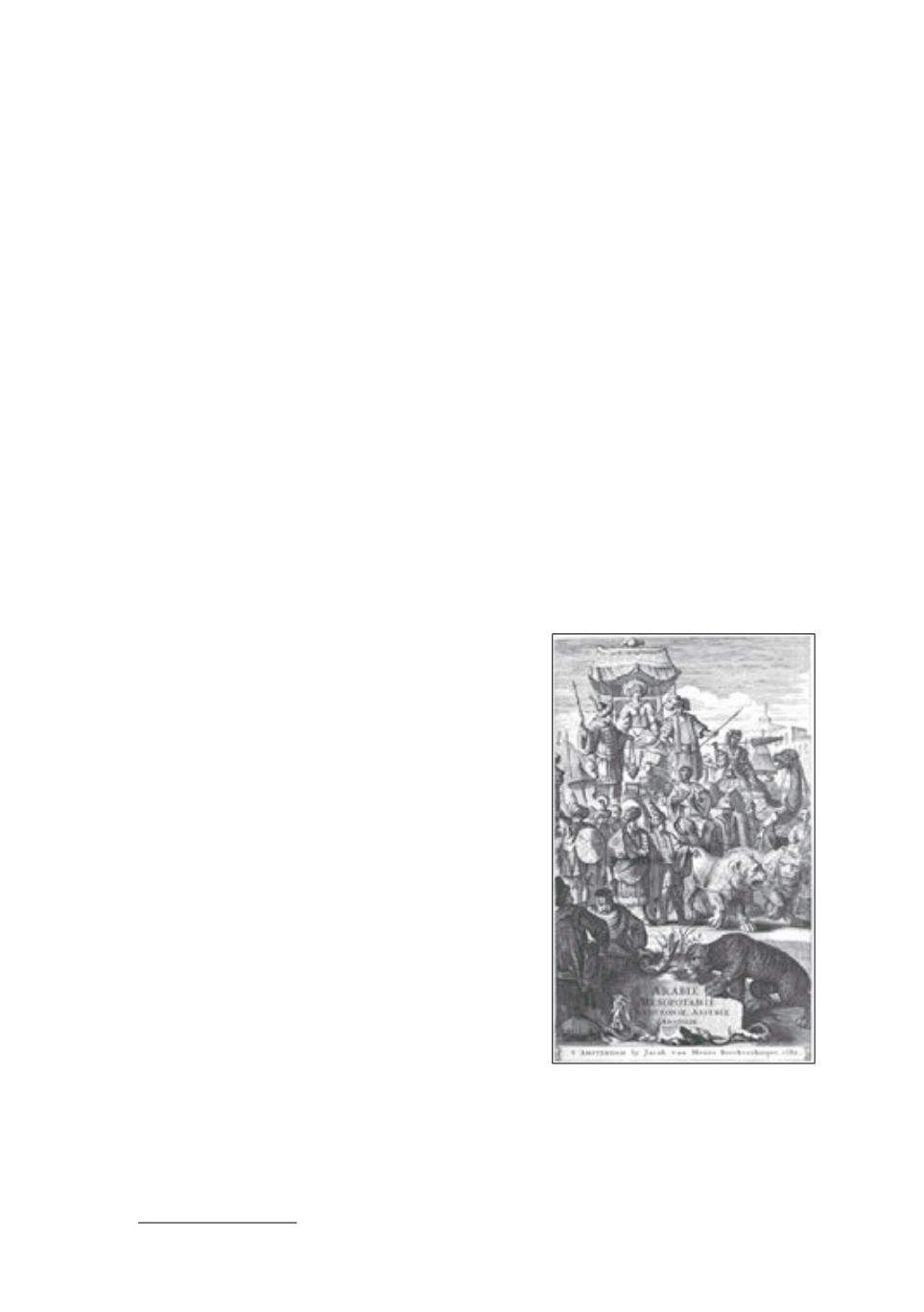
[Asia - Arabia]
-
DAPPER, Olfert
- Naukeurige
beschryving van Asie: behelsende de gewesten van
Mesopotamie, Babylonie, Assyrie, Anatolie, of Klein
Asie: beneffens eene volkome beschrijving van
gantsch gelukkigh, woest, en petreesch of steenigh
Arabie. Vertoont in een bondigh ontwerp van ‘s lants
benamingen, bepalingen, verdeilingen, steden, vlekken,
gewassen, dieren, zeden, en aert der inwoonders,
bestiering, geschiedenissen en godsdienst, inzonderheit
die van d’oude Arabieren, Mahomet en Mahometanen
(...). Amsterdam, J. van Meurs, 1680, 2 parts in 1 vol.,
folio, cont. calf (lower part & cover sl. stained), gilt orn.
spine on 6 raised bands (joints sl. rubbed, sm. repairs at
lower part), [8]-357-[3], 324-[4] pp. (endpaper loosening,
lower part missing, tear in p. 83, 2nd part with lack of
some paper, lower corner dampstained throughout, esp.
in 2nd part and somewhat mouldy at last quire, sm. tears
in lower margin of pl. “De tooren van Babel”). Good
copy.
Cfr. ill.
€ 500/700
1st edition
of this detailed description of some Asian islamic
countries and Arabia (part 2) by O. Dapper (1639-1689),
also translated in German.
Engr. ills
: title,
3 double-page
maps
(“Delineatio regionis Bassora cum pagis”, “Natolia quae olimAsia minor”, “Nova totius Arabiae
foelicis, Petraeae et desertae”),
13 double-page views
(some folding, 4 signed by Charles Vasteau and
one by K. Decker) showing
Babel and the Tower (2)
,
Bagdad
,
Ninive
,
Ephese, Smirne, Magnesie
,
etc. and
22 half-page ills in text
. Title in red & black. Text in 2 cols. Ownership entry on endpaper
“Franciscus Uyttenbroek Lier”.
Ref.
Haitsma Mulier/Van der Lem 141g. Tiele 300. STCN (i.a. BL). BnF.
1029