


 235 / 416

235
792 [Atlas - world]
-
BRAUN, Georg & HOGENBERG, Frans
- Théâtre des cités du monde. Premier
Volume (- Second volume). [Cologne, s.n., c. 1575-c. 1587], folio, orig. calf (rubbed, def. corners), gilt
centerpc. on covers, spine on 6 raised bands (splitting joints, heavily rubbed, def. at head & tail), 2 parts
in 1 vol., engr. title (lower and left edge underlaid, slip of paper of upper margin torn off, frayed right
edge, +/- 10 cm tear, sm. ink stain), [6] ff.-51 pls-[12] ff., [4] ff.-55 pls-[4] ff. (sm. marg. wormtrack, a
few minor splitting c’folds, sl. soiled margins, some). Good copy.
Cfr. ill.
€ 8000/12000
French trsl. of the “Civitates Orbis Terrarum”, by Georg Braun, canon of Cologne Cathedral, who
gathered information from travellers, geographers and scholars throughout Europe and beyond.
Franz Hogenberg, a friend and colleague of Mercator and Ortelius, engraved the maps, and
was later succeeded by his son Abraham. It represents by 1617 and after several editions, a most
remarkable set of over 500 city plans and town views. The present copy gathers 2 t.-p. (title pasted
on in the centre of the nice engraving),
203 maps and views on 107 plates
(Part I: 52 (of 59) and
Part II: 55 (of 59)): Spain (10), Italy (10), Germany (27), Netherlands (14), Belgium (6), France
(14), etc. Present are i.a.
views
of Lübeck, Bilbao, Huy, Maastricht, Innsbrück, Ieper, Nürnberg,
Danzig, Granada, Barcelona, Mombassa, Calcutta etc. and
maps
of Aken, Paris, London, Lyon,
Cologne, Augsburg, Rome, Naples, Constantinople, Jerusalem, Caïro, Mexico, Middelburg,
Utrecht, Amsterdam, Moscou, Damascus, etc. Not present are: Sevilla, Brussels, Bruges, Antwerp,
‘s Hertogenbosch, Frankfurt, Venice, Santander, Orléans, Basel and Algiers. This world’s first
systematic city atlas was one of the most important publications ever undertaken and among the
greatest achievements in the history of cartography.
Ref.
Koeman II: B & H 13 - 14.
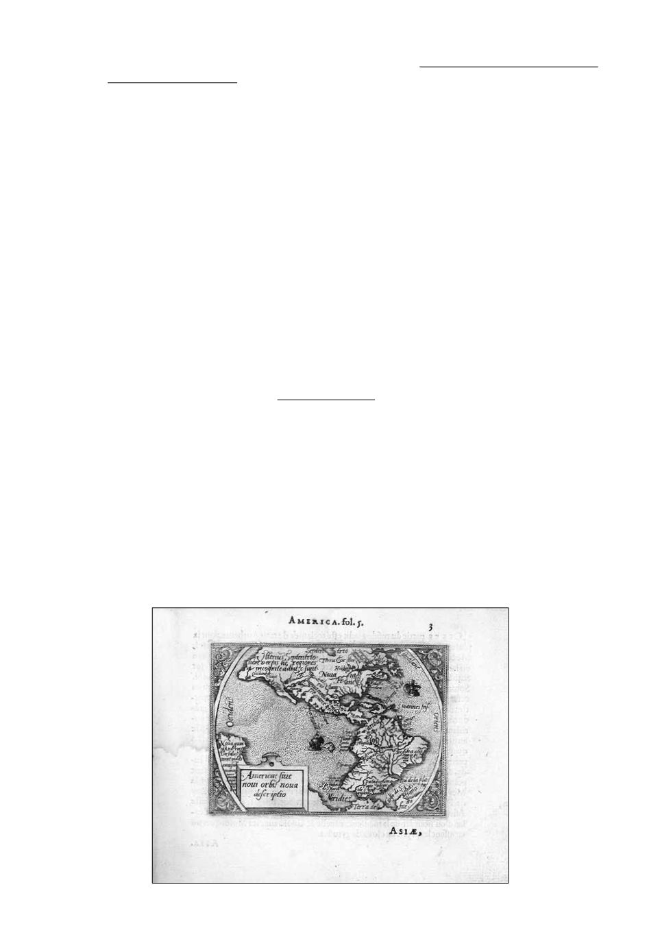
793 [Atlas - world]
-
HEYNS, Peter
- Le miroir du monde, reduit premierement en rithme brabançonne,
par M. P. Heyns, et maintenant tourné en prose Françoise (...) Theatre d’Abraham Ortelius (...).
Anvers, Chr. Plantin for Philip Galle, 1583, obl. 4to, cont. calf (rubbed, stained, some sm. holes),
triple blindstamped & 1 gilt ruled border on covers, central gilt orn., gilt spine on 4 raised bands
(rubbed, def. on head & tail), (lacking text ff. ++1, f. 1 & 24, world map & map of Switzerland torn
out, stains on 1st ff., waterstains, some marg. soiling).
Cfr. ill.
€ 600/800
First French ed. of this innovative pocket-atlas
, previously edited in Dutch as “Spieghel der
Werelt”, by the engraver Philips Galle and the rhetorician Peter Heyns (1537-1598). Comprising
80 miniature maps
(4 double, folded), reductions of those in Abraham Ortelius’ “Theatrum Orbis
Terrarum”. With 1 engr. “Speculum mundi” and 2 small marg. drawings. Loosely inserted, 2 small
Ortelius maps: “Patavianum” (worming) & “Corsica”.
Ref.
Voet IV, 1831. Koeman, III, p. 75, nr.
50. Not in Belgian or Dutch collections.
793