


 80 / 148

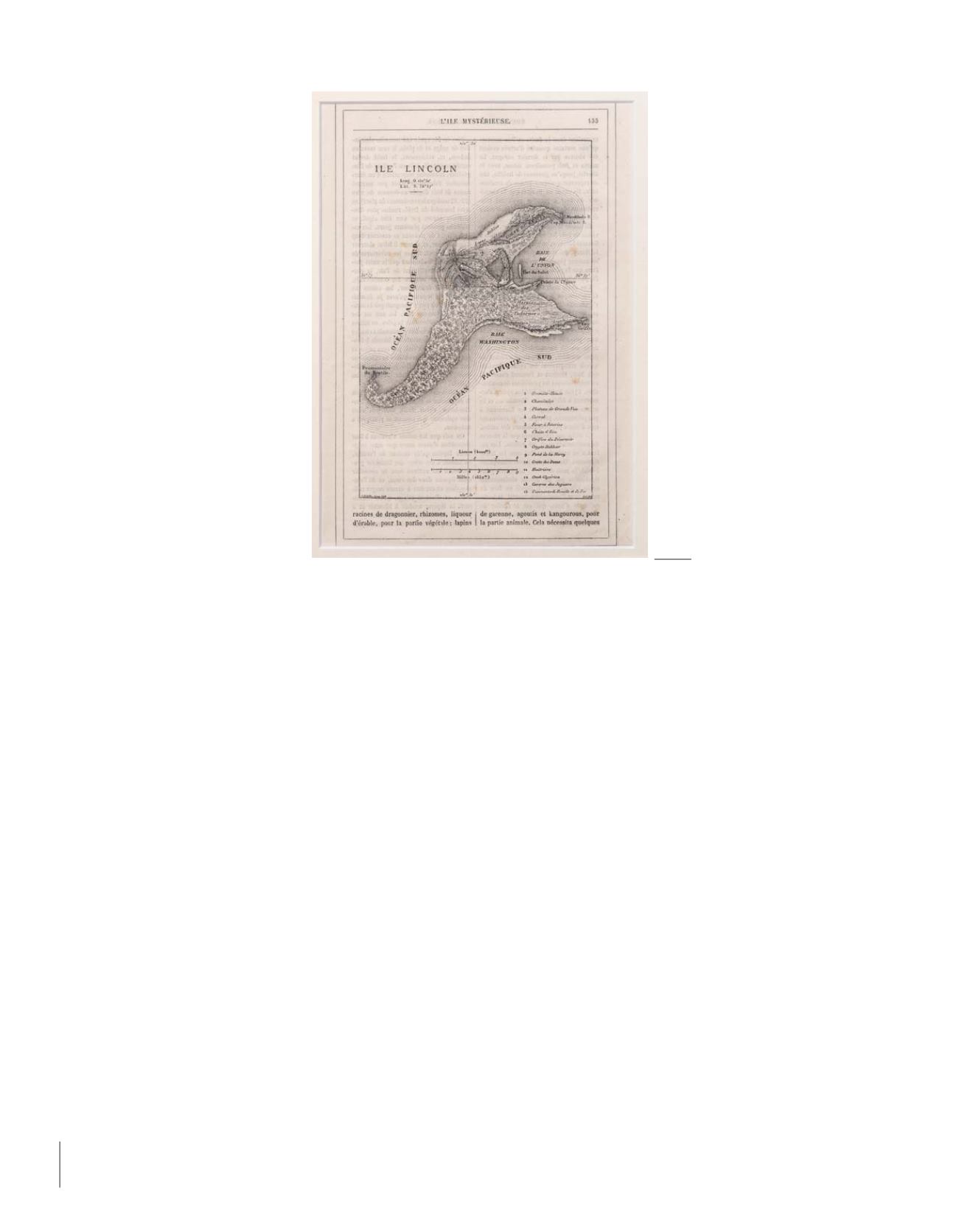
L’ÎLE MYSTÉRIEUSE (The Mysterious Island)
Map of Lincoln Island drawn and inked by Jules Verne himself (1874)
Map drawn and inked by Jules Verne in 1874 showing Lincoln Island for
L’île Mystérieuse
/ Corrected proof,
annotated and signed by Jules Verne / Published final engraving.
The Mysterious Island
, more so than
Twenty Thousand Leagues Under the Sea
or
Around the World in Eighty Days
, is unanimously
thought to be Jules Verne’s finest novel and the one in which his genius found its best expression. The work can be considered a
culmination. And Lincoln Island, the last port of the
Nautilus
, Captain Nemo’s final refuge and then his sanctuary, is at once its
setting and its starring character, whose anger we come to know. It is often in the islands that Jules Verne located his dreams and his
utopias. And it also there that they disappear into the depths. The Mysterious Island is a key – not to say
the
key – to his entire work.
While nearly all the manuscripts of Jules Verne have been found and conserved, drawings by Verne can be counted on the fingers of one hand.
Do drawings by Jules Verne exist?... Nothing… or almost nothing that could be considered an artistic work and that one would be tempted to publish.
A visionary like Jules Verne might have shown some proclivity for art. The same can be said of Victor Hugo, whom he admired. But the author was
decidedly not an artist.
He produced nothing that can truly impress us … except for one map.
But what a map!
It was the only one he was to leave to us, the only major work still needed to crown his graphical heritage. “His” map of the Mysterious Island…
There could only be one major drawing of such force and inventiveness by the hand of Jules Verne. It is the one included in all good illustrated editions
of the novel, both French and foreign.
And here is that drawing, in all its majesty.
The map is not only a unique document. It is imperial, not to say imperious. And more than that, it is miraculous. Why? Because no one expected it to
exist, and because it seems to shine like a star at the summit of the pyramid of graphical remembrances of the author, the only one we would be tempted
to select out of all the others – as if there could be a single one that could be compared to it.
What else could possibly be as spectacular, except for a plan of the
Nautilus
drawn by the author himself? And it is not a question of the sheer volume
of paper, the number of pages covered by the author’s pen. It is a question of force. And this document has the force of an entire manuscript, if not a
summation of his entire oeuvre.
But its importance also comes from the fact that it is also
alive
, overflowing not only with geographical information, but also other information that
tells us about how his work evolved, and is not found either on the final map or in the narrative. It is much more elementary than the final map; it
is a first draft. It is Jules Verne’s working document, an imaginary exploratory map he drew for his personal use, yet with the intention of sharing it
with his readers and having it reproduced.
Seen in this way, it has the power of a codex.
Jules Verne imagined and then drew “his island” as he would have allowed no-one to else to draw it, as, ten years later, Robert Louis Stevenson – himself
a reader and critical admirer of his works – was to do for his
Treasure Island
. More eloquent than the descriptions – one picture is worth a thousand
words –, his map was as indispensable to him as his texts. With its help, he was able to dive again and again into his work and find his place again;
it was the foundation for his imaginings and wanderings in building and directing his narrative.
76
78
Jules VERNE | Collection Weissenberg - Première vente