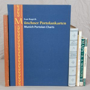
(CARTOGRAPHIE - PORTULANS). KUPCIK (Ivan). Munich Portolan Charts « Kunstmann I-XIII » and ten further Portolan Charts. Munich et Berlin, 2000.
Description
“A revised and supplemntary new edition of Friedrich Kunstmann’s original work of 1859 with 13 rendered colored plates and ten further sea charts of early XVIth century from the Munich Portolan Charts collections including those missing since 1945”. Édition bilingue allemand-anglais. Bibliographie. Index.
▬ On joint :
• The World Encompassed. An exhibition of the history of maps held at the Baltimore Museum of Art, October 7 to November 23, 1952... Baltimore, 1952. In-4, XIV + (63) ff & LX planches, broché, couverture illustrée. Catalogue d'exposition qui décrit 282 cartes ou atlas et qui en reproduit une grande partie dans 60 planches.
• BAGROW (Leo). Die Geschichte der Kartographie.
Berlin, Safari Verlag, 1951. In-4, 383 pp. toile grise décorée de l'éditeur. Importante contribution à l'histoire de la cartographie. Elle est illustrée de 7 planches en couleurs hors texte dont une à double page, 112 planches à pleine page dans le texte et nombreuses figures et cartes dans le texte.
• GRAVIER (Gabriel). La Lettre et la Carte de Toscanelli à Fernam Martins et à Christophe Colomb. D'après Henry Vignaud. Rouen, Caniard, 1902. In-8, 23 pp. broché. Tiré à part.
• RIMBERT (Sylvie J.). Cartes et graphiques. Initiation à la Cartographie appliquée aux Sciences Humaines. Paris, SEDES, 1964. In-8, 236 pp. broché. 88 figures dans le texte.


