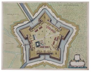
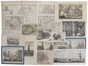
(FLANDRE–BELGIQUE) — Un lot varié de topographie historique des XVIIe et XVIIIe siècles, avec entre autres deux plans de Bruxelles (y compris un coloré), deux petites cartes de Malines et ses environs, une vue et deux plans de Tirlemont, 'A...
Description
■ (FLANDERS–BELGIUM) — A varied lot of historical topography from the 17th and 18th century, with a.o. two plans of Brussels (one coloured), two maps of Mechelen and surroundings, one view on and two plans of Tienen, 'A new map of the Netherlands or Low Countries', furthermore maps of Luxembourg, Artesia and six sieges (Tienen, Kallo, Nieuwpoort, Dendermonde, Alost and Ostend) and picturesque views on Geraardsbergen, Utrecht, the Antwerp Stock Exchange, four views on historical buildings in Amsterdam, etc.
Various dimensions.
• Tot. : about 37
DESCRIPTION NL.
■ (VLAANDEREN–BELGIË) — Een gevarieerd lot historische topografie uit de 17de–18de eeuw met o.a. twee plattegronden van Brussel (w.o. één ingekleurd), twee kaartjes van Mechelen en omgeving, een zicht en twee plattegronden van Tienen, 'A new map of the Netherlands or Low Countries', voorts kaarten van Luxemburg, Artesië en zes belegeringen (Tienen, Kallo, Nieuwpoort, Dendermonde, Aalst en Oostende) en pittoreske zichten op Geraardsbergen, Utrecht, de Antwerpse Beurs, vier zichten op historische gebouwen in Amsterdam, etc.
Diverse afmetingen.
• Tot. : ong. 37 ex.


