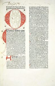

SANTINI, Francesco e Paolo. Atlas universel dressé sur les meilleures cartes modernes 1776.Venezia, Chez P. Santini, s.d. [1776-1780].
Estimation :
Start Price 7 000 €
Description
2 vols. Folio; Contemporary binding in half calf and marbled paper Work entirely engraved on copper.
I vol: illustrated Titlepage, 1 leaf with the index of plates 1-60; 59 maps in contemporary coloring. Missing the plate 10 Majorca and 22, Linguadoca; at the end added the pales of Gibraltar and Cadiz;
II vol: 1 leaf with the index of plates 1-63; 60 maps at double page in contemporary coloring. Missing the plate 12, 13 e 22, Padouan, Trevisan, Frioul.
A total of a Titlepage Frontespizio and 119 maps engraved in contemporary coloring.
RARE FIRST EDITION.
The work of Santini is one of the most significant examples of printed Universal Atlas in the '700 in Italy. The plates, all with fine watercolor in the age, Title within rich cartouche, place names and geographical descriptions, are signed by Santini and resumed by the best geographers of the time, including the Anville, Bellin, Bonne, Janvier, Robert de Vaugondy, Rizzi-Zannoni, Homann. Besides the two globes, there are general maps of Europe, Asia, Africa and America: Italy is outlined as a whole in the second volume, followed by the regions of the maps; the plates are involving Japan, China, Africa and the Americas, represented in 10 regional maps.•Un solo esemplare censito nelle biblioteche italiane. Phillips 647, per la successiva edizione di REMONDINI del 1784.
Slight sign of foxing, nice copy
